South East Asia on Two Wheels

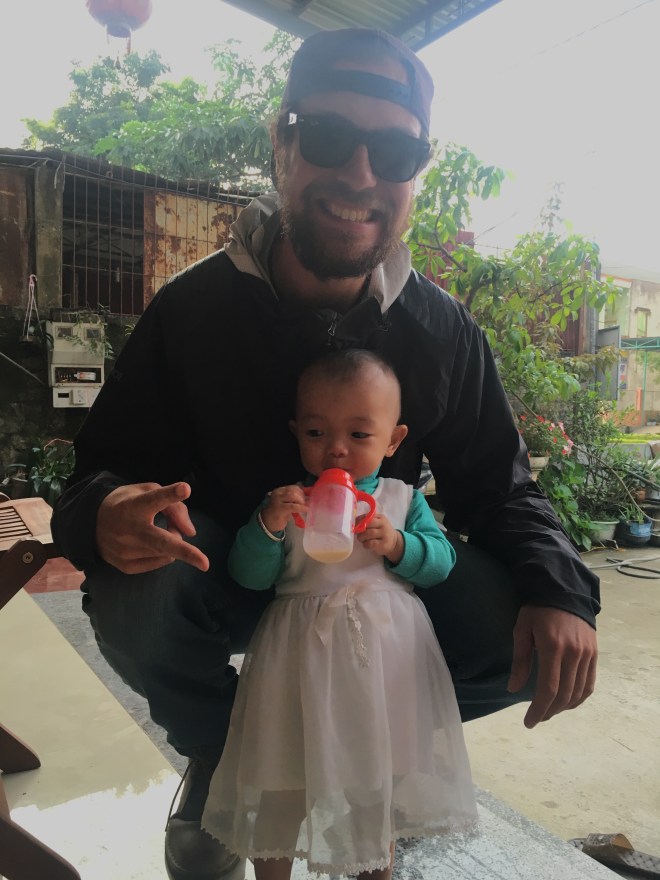
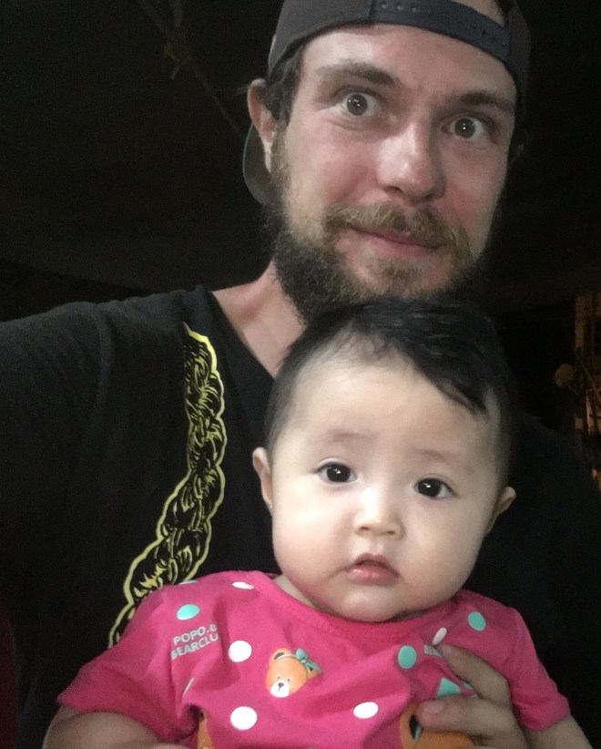
Riding through Vietnam.

This is a live journal of my travels through Vietnam.  Once I am finished, I will finalize and organize this into a trip report.

Live map:

Danang

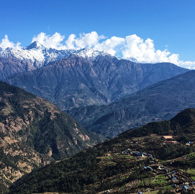
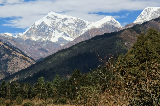
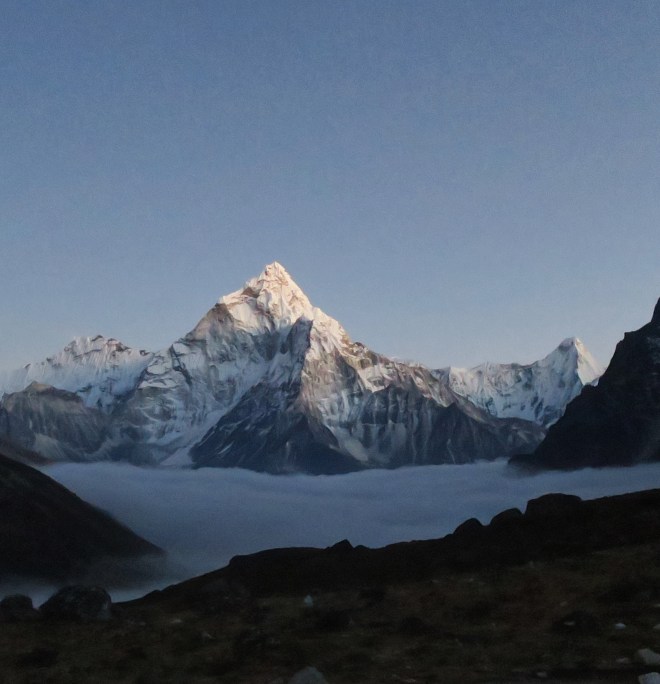
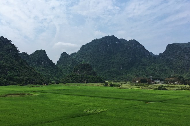
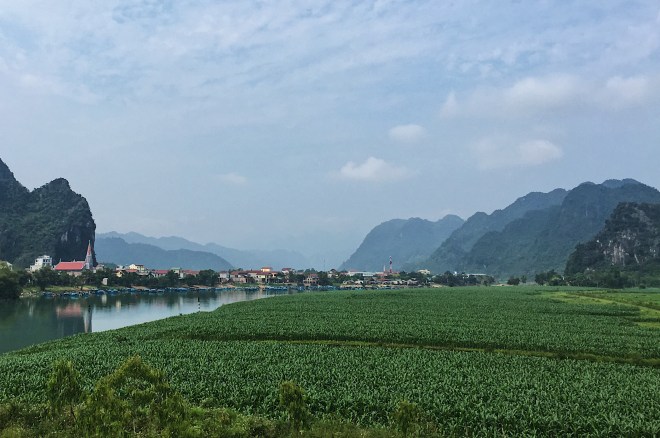
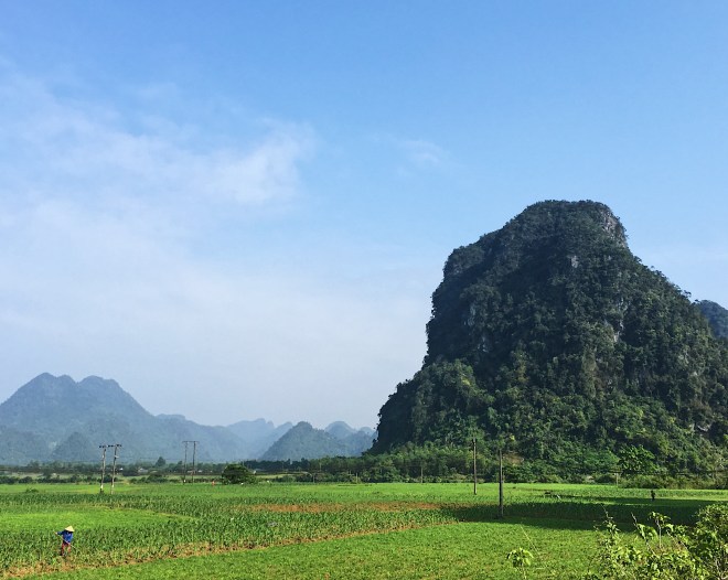
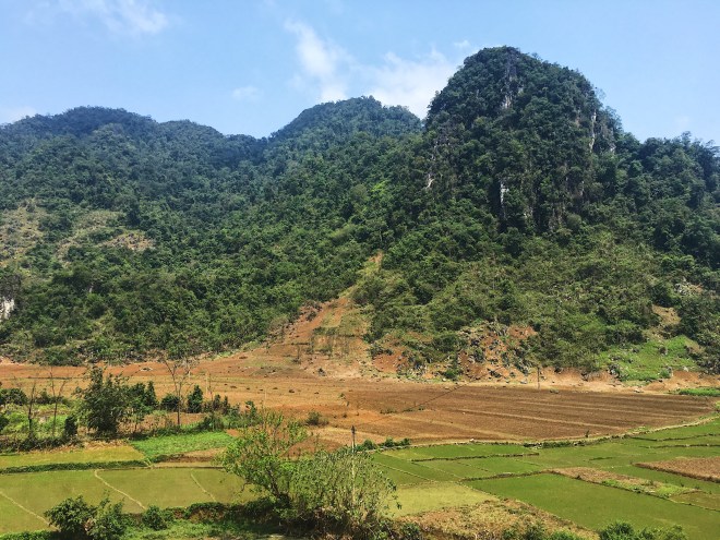
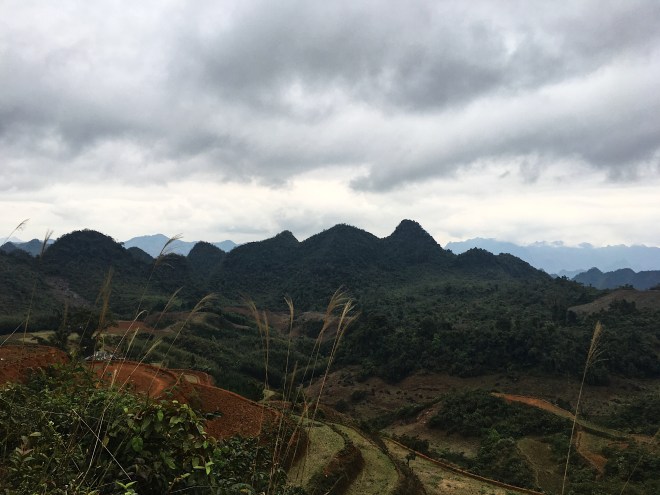
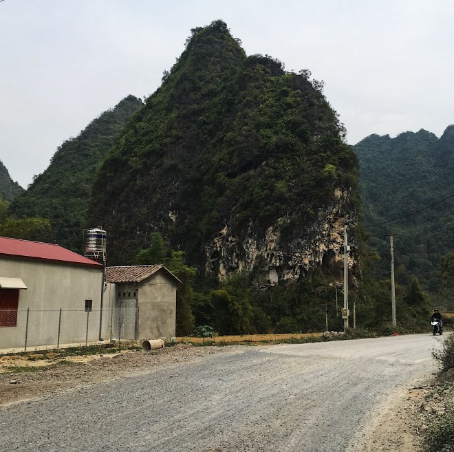
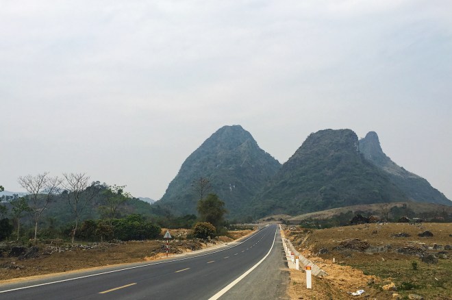
Phong Nha was gorgeous, but the town itself was really touristy, and felt pretty obnoxious, so I stayed one night and continued South, with the goal being to get to Danang.  Driving out was incredible, as the limestone mountains seemed to shoot straight out of the lush, green farmland.  It was a bit of a pain getting to the coast, as it required a bit of highway switching, but I finally made it to Vinh Moc Tunnels, which marked the beginning of drive South, down the coast.

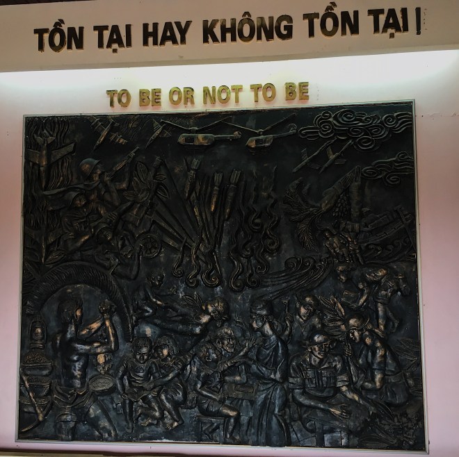
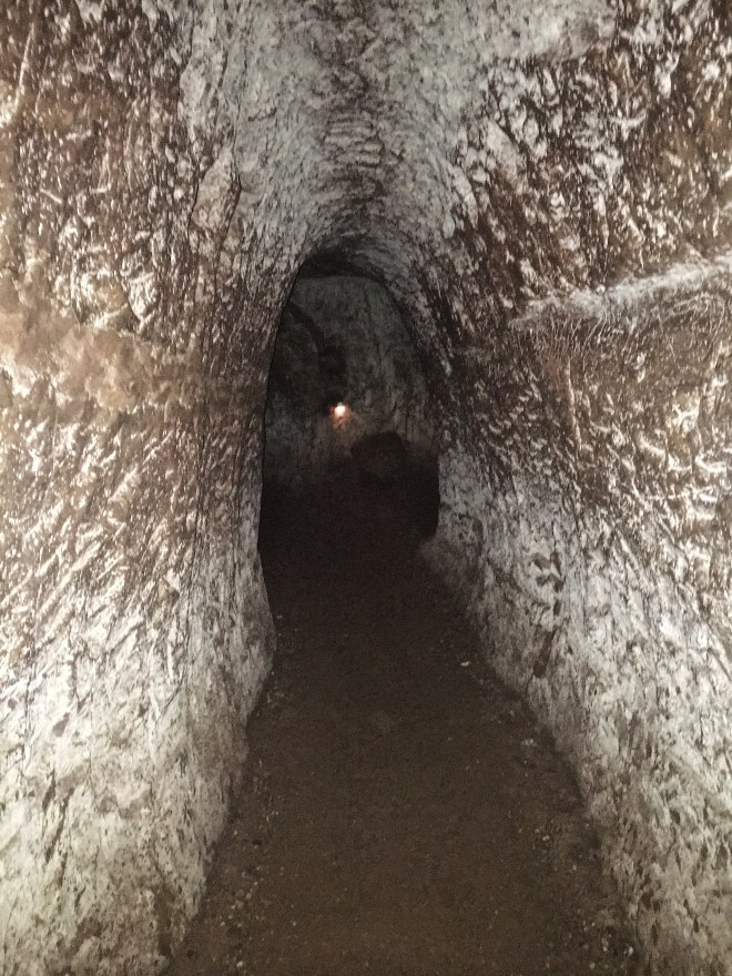
The tunnels were pretty fascinating.  They were built far underground during the American invasion, and served as a base and hiding place for the locals.  Few people died, and people were actually born in these caves, as they were impervious to the bombs being dropped by America.  I walked into the tunnels and wandered around until the claustrophobia got the best of me, and got back on my bike.

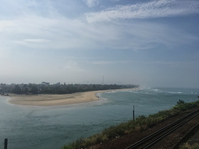
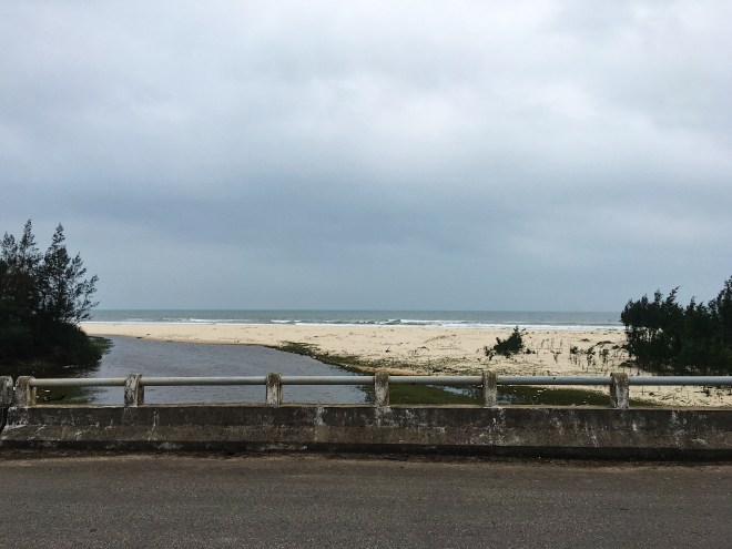
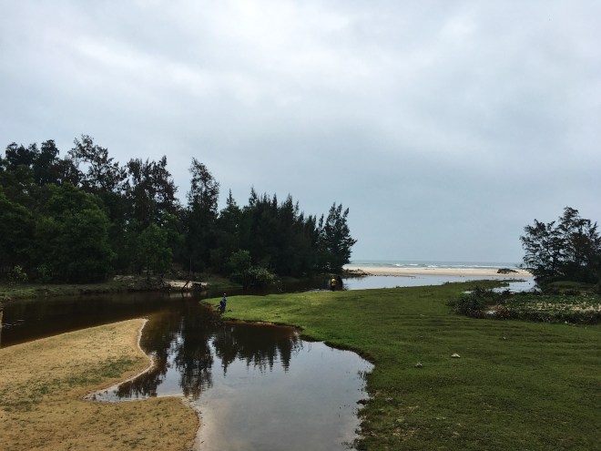
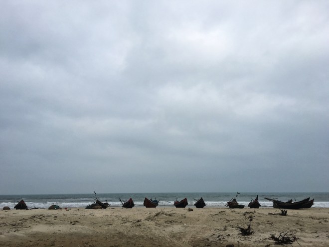
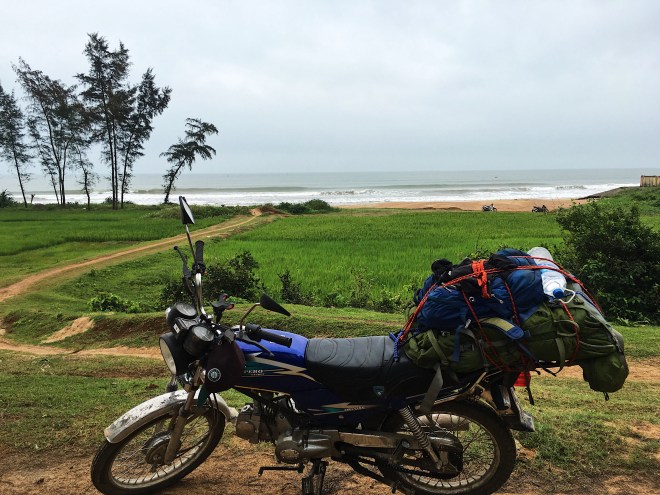
The next section of road was incredible.  Totally deserted, well paved coastal roads, with endless ocean views.  I loved the smell and sound of the ocean, and probably wasted too much time taking pictures and just walking onto the beach.  After about 60 km, the road started going into tiny villages, which are always interesting, but really challenging to drive through.  Kids on bikes riding 4 wide on narrow roads, trucks driving way too fast, people stopping erratically in the middle of the road, it’s chaos.

The scenery turned to shit right around when the weather turned.  It started pouring on me, and the woods and ocean turned into giant garbage fields.  I started looking for a guesthouse, but after a bit of riding in the rain, my phone stopped working.  I was able to find one on maps.me, and even booked a room.  After an hour of shit riding in the pouring rain, I finally got into town and drove to where the guesthouse was supposed to be.  I didn’t see anything.  I asked a few locals, and they all pointed me down the road, to where I later found out was a few expensive hotels.  After an hour and a half of frustrating navigation, I found a relatively cheap guesthouse and called it a night.

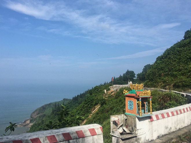
The drive into Danang was sunny and easy, topping off with Hai Van, a gorgeous mountain pass overlooking the ocean, emerald green forests, and the beautiful city of Danang.  I spent a few days here hanging with my dude Andy, who I met in Nepal, getting some rest, partying, and getting my bike fixed.

File_009 (5)
Dope ocean views from the top of Hai Van.
File_008 (6)
It looks like a greener version of Big Sur!
File_007 (7)
The road leading up to Hai Van was almost as nice as the top!
File_006 (10)
A cool little shrine on the side of the highway.
File_005 (12)
Some nice beaches on the way.
File_004 (12)
These graveyards were everywhere, and they are awesome.
File_003 (12)
Empty coastal roads.

File_000 (29)

File_001 (17)
Some villagers fishing.
File_000 (27)
These fishing boats were just chilling on the beach.

File_006 (9)

File_005 (11)
A mural from the Vinh Moc Tunnels.
File_004 (11)
American bombs turned into art.
File_000 (28)
These tunnels were where villagers lived for years, hiding from the American bombs being dropped overhead.,
File_003 (11)
I only made it 20 minutes down here, I can’t believe people lived down here.
File_002 (14)
The village right outside of the Phong Nha caves.
File_001 (16)
Gorgeous views right outside of Phong Nha.

Phong Nha

The drive out of Hanoi was pretty irritating.  There is a straight freeway that goes to Ninh Binh, which was my goal for the day.  Apparently, no motorcycles are allowed on this freeway, as that would be dangerous? So this guy ran in front of my bike, pointed to the sign, and basically told me to back track and use another road.  This meant I had to drive the wrong way down the freeway and back into a 5 way intersection, that of course didn’t even have a yield sign, let alone a traffic light.  Sounds much safer than just driving down a 3 lane freeway huh?

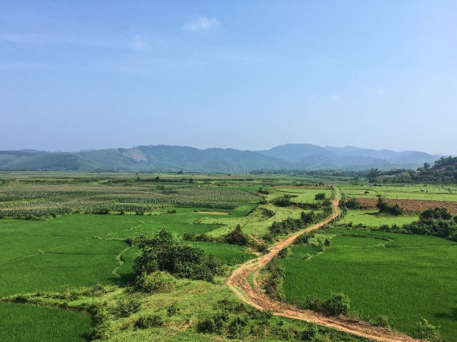
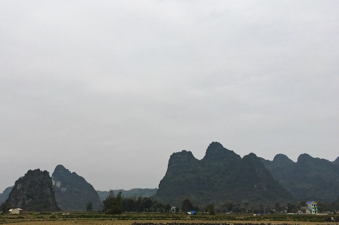
Ninh Binh was cool.  I left out of there, and did a little loop around some limestone mountains, before getting on the Ho Chi Minh Highway, which goes all the way to Ho Chi Minh City.  The weather held me up for 2 solid days in some really weird village, and up to that point the drive was only ok.  After driving in the North for so long, the limestone mountains don’t look as cool as they used to.

As I go further South, the scenery is getting nicer and nicer, along with the weather and people.  I was going to make a side-trip into Laos to do the Thakek Loop, but they wouldn’t let me across the border, because motorcycles weren’t allowed to enter Laos through this particular border (I don’t believe this).

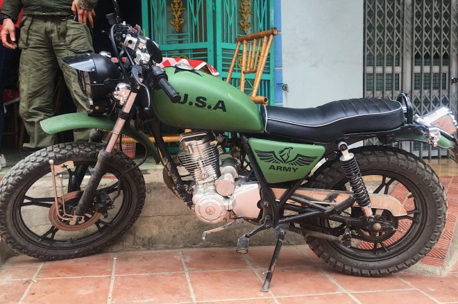
I was still getting a little bored, and ready to leave.  I have been in Vietnam for over a month, and am starting to get itchy feet.  I did have a turning point which slightly changed my mind though.  On my way to the Laos border, the roads turned to shit.  I think they finally broke my bike, as the whole back end came off the frame and down onto my tire.  I limped up the highway for a few kilometers until I found a place to pull over, which was in front of what looked like an abandoned shack.  A dude in army fatigues came running out, and I asked him if he had tools.  He dragged me into the shack, and his friends forced lunch and rice wine on me while he fixed my bike with actual shoe string.  Maybe Vietnam isn’t so bad I guess?

After getting my bike fixed by a mechanic (for $7!!), I found a cheap motel in Pho Chau, which was an awesome city.  I am now averaging about 200 km a day, and the weather, roads and scenery are all much better.
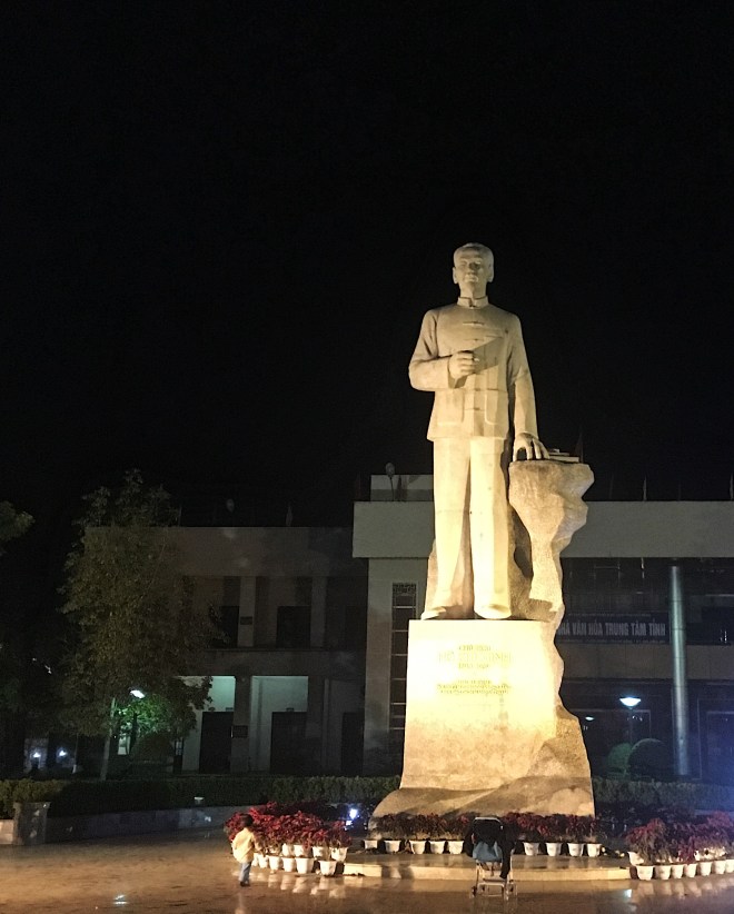
File_003 (10)
This adorable baby who lives at the homestay I am at. She just walked up to me and offered me her bottle.
File_004 (10)
More gorgeous scenery on the HCM.
File_005 (10)
Clear, paved roads and sunshine!

File_006 (8)

File_002 (13)
Right by the border to Laos. I didn’t make it in, but at least the drive was nice.
File_001 (15)
Group pic of the dudes who helped me with my bike.
File_007 (6)
Lunch time!

File_000 (24)

Hanoi

The drive back to Hanoi pretty much sucked.  I got ran off the road a bunch, and traffic was a nightmare.  I broke the trip into 2 days, as I was losing patience and the will to drive anymore.  I stayed in some town 50 km West of Hanoi, in some dump.

Phu Yen


Another easy day, although I did get lost a few times trying to get onto 37.  I did have a pretty irritating interaction with my guesthouse owners.  They told me the room was 200,000, then showed me the room.  I agreed on the room, then went up and saw the AC unit had no remote.  I went down and asked for it.  They gave it to me, and said something I missed.  I came down to pay, and all of a sudden the room was 250,000.  After a lot of arguing over google translate, they were finally able to tell me the AC unit costs an extra 50,000.  I gave them back the AC remote, and the price was 200,000 again.  I don’t think they were trying to be malicious or rip me off, just a really stupid way to communicate.  They sure don’t make things easy sometimes.

File_002 (12)
More fun mountain roads!
File_003 (9)
A really cool bridge I drove over.

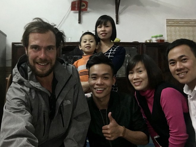
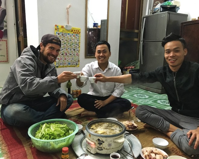
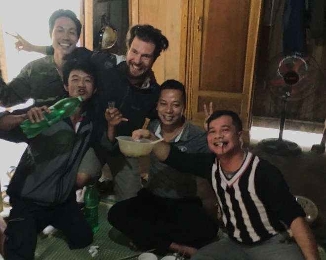
Vietnam is funny though.  I will have some pretty annoying things happen like that, and be generally annoyed and ready to leave.  Then something amazing happens, and I love the country all over again.  I went to dinner, and through a series of pointing and grunting, ordered.  These two kids were also waiting for dinner.  They invited me to eat and drink with them.  We all shared food, went through 2 bottles of wine, and had a great time (talking exclusively over google translate).  They didn’t let me pay for anything, and drove me home on their scooter (they insisted, even though my guesthouse was 200 feet away).  It was a great last night for my trip up North.

File_006 (7)
Really great dudes. Thanks for a fun night!
File_005 (9)
The owner of the restaurant gave me her baby?
File_004 (9)
The baby is better at selfies than I am.

Son La


A pretty easy day, not too scenic.  I had to call it early as my hand was starting to hurt from the accident.  Son La is not as cool as I expected, and this guesthouse might be the grossest place I’ve ever slept.
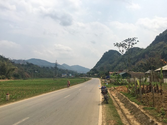
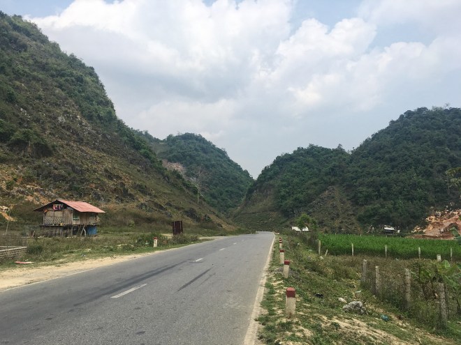
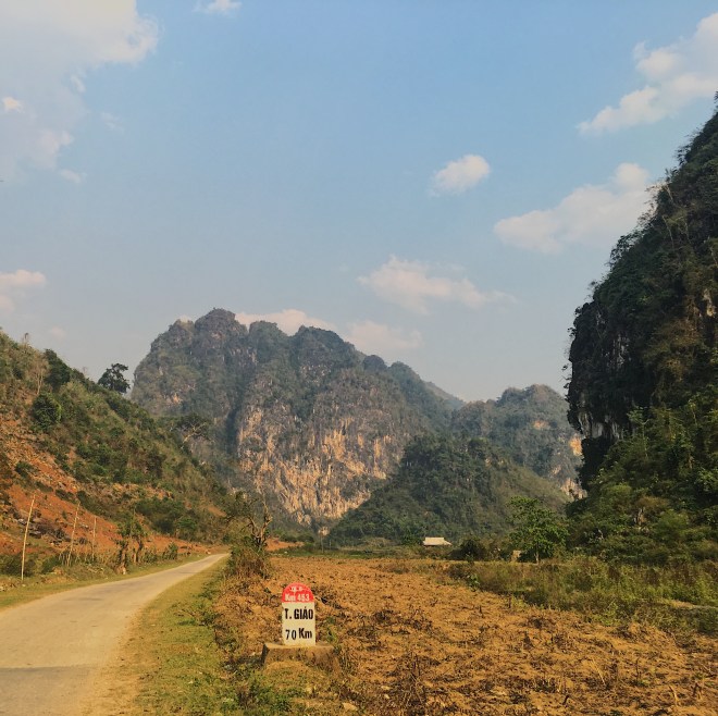
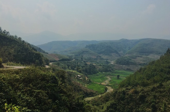
File_000 (23)
Easy roads all day.
File_001 (14)
Nice and empty.

Tuan Giao


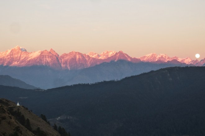
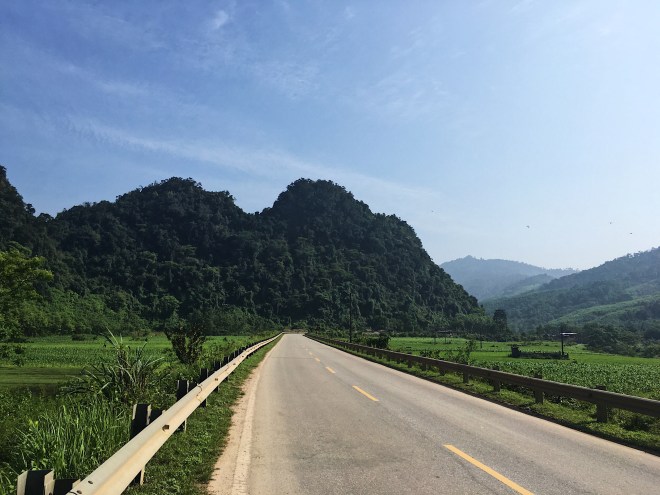
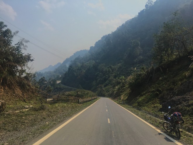
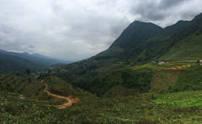
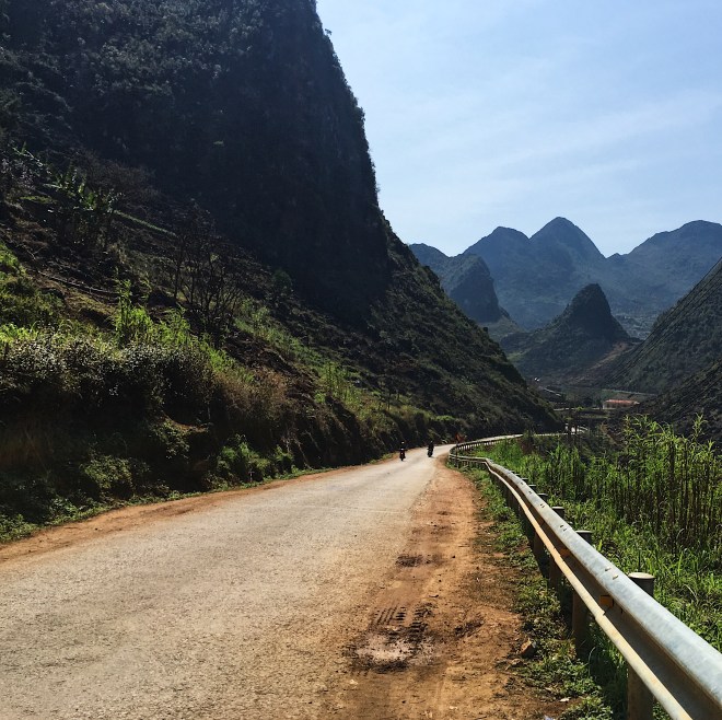
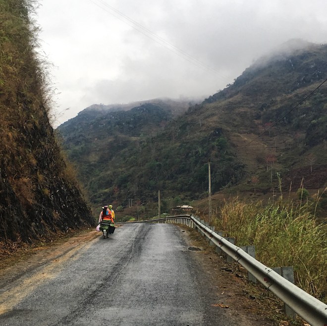
This was a brutal day, and I got in a lot later than planned.  I figured I would find a guesthouse or somewhere to stay before Tuan Giao.  I guess the benefit of the almost entirely empty roads all day outweighed the lack of accommodation though.  Gotta take the good with the bad.  This was also one of my best days, and I absolutely loved it.  Aside from a few rough patched, the road was paved and well maintained, although a bit narrow the whole time.  The views and scenery were incredible the whole trip.  The last few hours especially, during the golden hour, were absolutely magical.  I should try to do more driving during this time of day.

File_006 (6)
So many colors.
File_005 (8)
70 km is over 2 hours on this road. Oh well!
File_004 (8)
Riding in the sky.
File_003 (8)
I rode along this amazing river for over an hour.
File_002 (11)
So much green!
File_001 (13)
Perfect roads. Almost no other cars either.
File_000 (19)
The day started out amazing.

Sin Ho


I had a really mellow day today, as I am still pretty mangled from the accident.  The bike drives fine, but I didn’t even leave my hotel until around 1 pm.  The drive was really nice, although nothing that really jumped out at me.  It was just a nice, easy drive with very few other cars, which was really nice.

File_004 (7)
Just a nice, mellow drive into the mountains.
File_003 (7)
Paved, empty roads!
File_002 (10)
Pretty nice countryside on the way in.

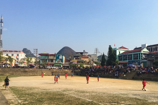
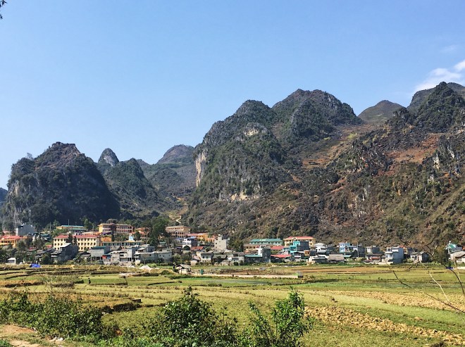
The highlight of today is the town I am staying in.  Sin Ho is probably one of my favorite cities so far on this trip.  I’ve been staying in either really touristy places, or awful Chinese border towns.  Those are interesting, but not somewhere I enjoy being.  Sin Ho is perfect.  There are exactly 0 Western tourists here, but unlike those weird border towns, people are super friendly, the town itself is super nice, and it’s the perfect size.  I can walk through the whole thing in 20 minutes, but find anything I would possibly need here.

When I pulled into town, I saw a giant crowd around this field.  The whole village was watching a soccer game (yes, not a football match, I don’t know what that is).  Sports! I sat down to watch for a bit, then went to go find my hotel.  I could hear the crowd from my hotel, so I decided to go back out.  They played like 5 games in a row, and everyone was so into it.  They were also pretty amused that I was there.  I had a nice dinner, chatted to a few locals, and had some shopkeepers ask if I was from California (how did they know?).  It was a really pleasant night.  I hope I can find more places like this.

File_000 (18)
Everyone likes sports!
File_001 (12)
It was awesome to just sit and watch a sporting event with people.

Lai Chau


Great roads, dry and sunny weather, and great views made for a good start to my day.  Sapa looked really touristy, so I am glad I didn’t stay there.  The views look amazing though, and the ride was great.

File_000 (16)
Another vertigo inducing, mountain hugging road.

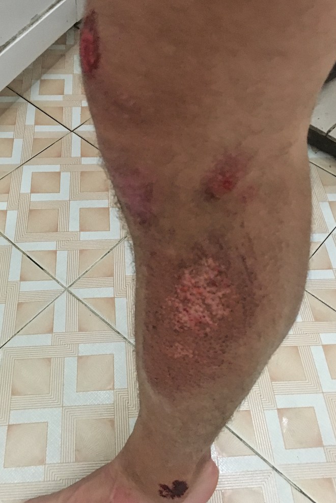
The biggest I issue I had was the traffic.  There were a lot of tourist vans and cars, in addition to the always insane semi trucks and buses.  This lead to my 3rd (1st major) accident here in Vietnam.  This car behind me pulled into the oncoming lane to pass me, only to see the semi truck coming right at him.  He quickly moved back into his lane, and just blasted me.  I saw this coming as soon as he pulled out to pass me, and I really should have jumped on to the shoulder.  Driving in Asia is weird and confusing, but one thing I’ve noticed is that the bigger vehicle always has the right of way.

I am not really positive what happened, I just remember the car coming at me from the side and hitting me, and kind of “coming to” under my bike, on the ground.  The driver of the car pulled over and helped me pull my bike up, and stood around as I got up and walked around a bit, yelling at him and calling him names he will unfortunately never know.  When I calmed down, he walked me to a villagers house, while his family walked my bike, and we cleaned up my pretty minor scrapes and road rash.  The bike and I were ok, so I turned down a ride to the hospital, and took off.

File_001 (11)
All things considered, this isn’t so bad! My arm and right palm look similar, and my bike, surprisingly, came out unscathed. Always wear a helmet.

All in all a pretty rough day, but it ended with dinner at some local restaurant.  These two little girls, maybe 4 and 10, were just fascinated with me.  They kept me company for my whole meal.

I left my guesthouse to grab a beer at around 11, and I heard what I thought was really loud porn.  I came downstairs, and the owner of the guesthouse was watching really loud porn on his phone.  He looked up at me, then back to his phone.  The weirdest thing was, he was just watching porn.  Nothing else.  This is a weird city.

Bac Ha


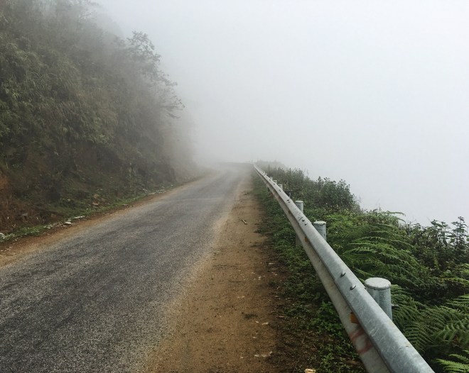
This was just a grind of a day.  There is rain in the forecast for Ha Giang today, and tomorrow for Lao Cai, so I had to get to Lao Cai today and wait out the weather.  If I’ve learned one thing here, it’s that riding in the rain sucks (also don’t use the front brake going down hill in bad conditions).  There was pretty low visibility so not a lot of good views, but the road, for all but one section, was perfect.  I just rode all day.
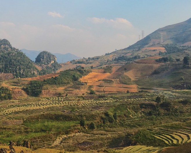
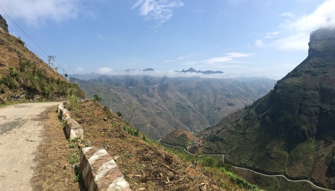
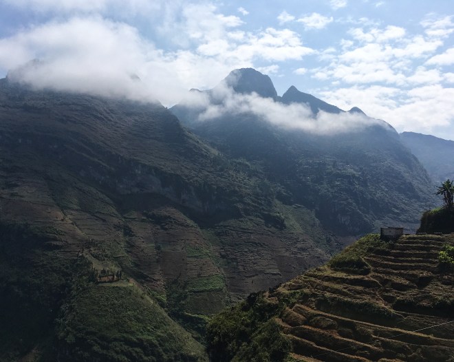
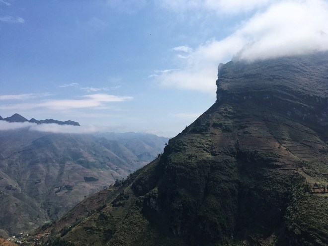
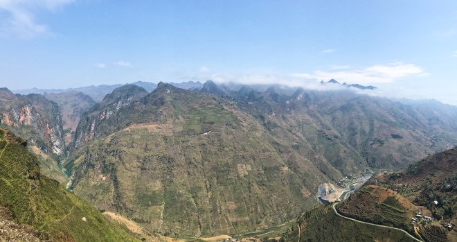
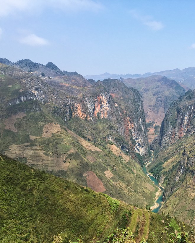
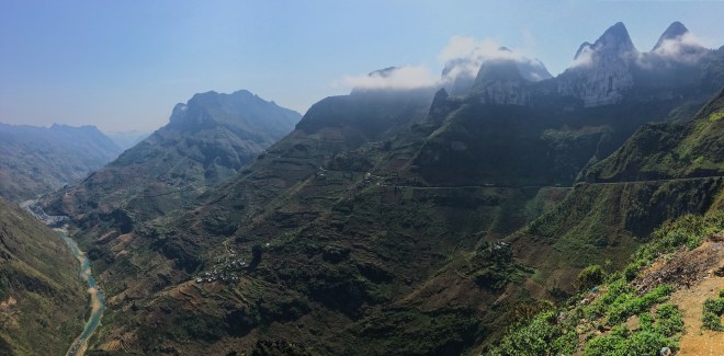
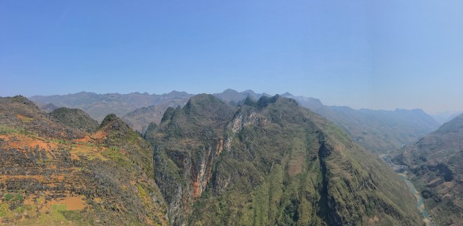
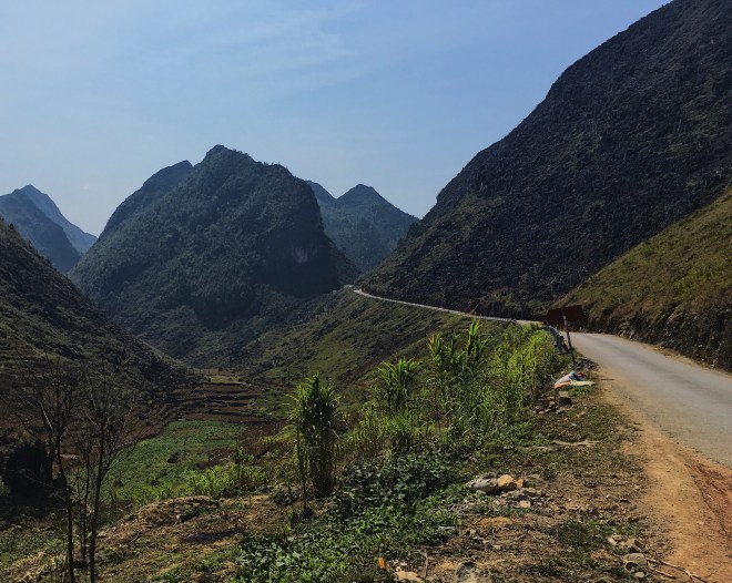
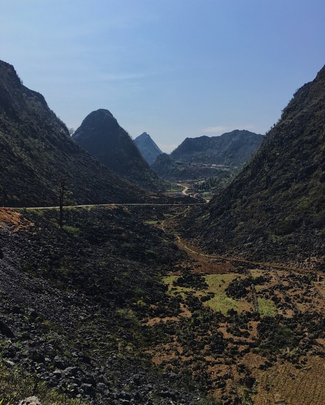
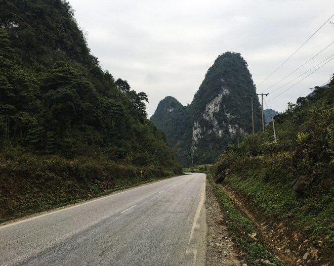
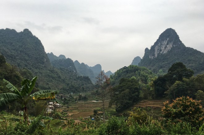
File_000 (13)
Mud roads, mountain passes, and buses.
The roads were mostly nice today, aside from this last stretch of highway going into Lao Cai.
One of the nicer views I got all day, before everything turned grey.

Quan Ba


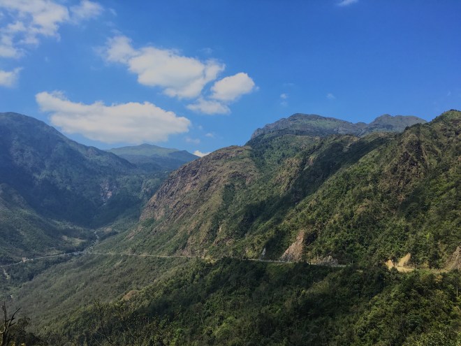
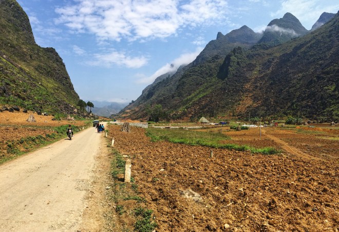
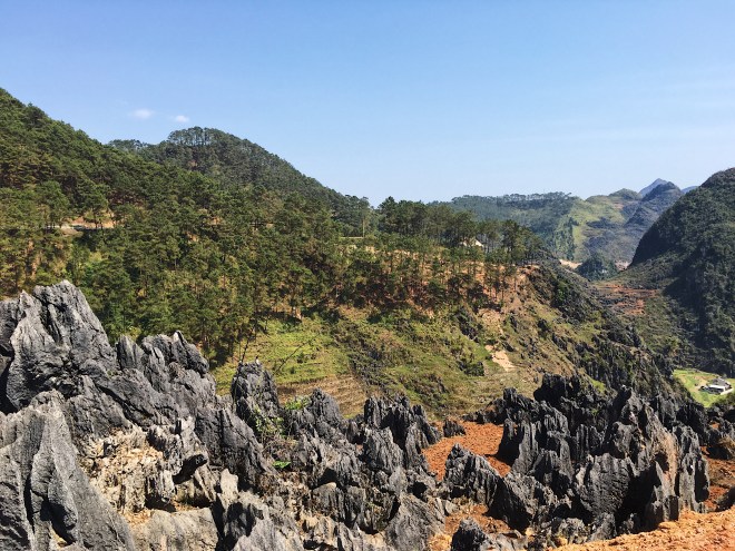
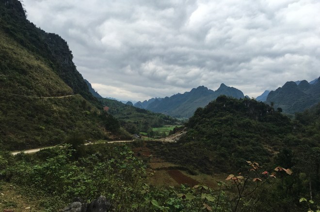
Thank god! Sun, paved roads, and insane views.  This was my favorite day of the trip so far.  I can’t say much, I will just let the pictures speak for themselves.  Ma Pi Leng Pass was absolutely insane.

File_009 (4)
Even the ride up was gorgeous.
File_008 (5)
The drive up Ma Pi Leng pass.
File_007 (5)
Hmong woman carrying a baby in a backpack!
File_006 (5)
I love the rice terraces up here.
File_005 (6)
Just enough clouds to make things pretty.
File_004 (6)
My bike chilling on top of the pass.
File_003 (6)
Look at this shit!
File_002 (8)
This reminded me of a more colorful Yosemite.
File_001 (10)
Looking back at the drive up.
File_000 (12)
Crazy colors.
File_009 (3)
More cool clouds.
File_008 (4)
A village on the other side of the pass.
File_007 (4)
More frontier areas!
File_006 (4)
Just some cool rocks.
File_005 (5)
Just an unreal drive.
File_004 (5)
Great roads the whole way!
File_003 (5)
I just get excited seeing the road in front of me.

File_002 (7)

File_000 (11)
Some kids playing soccer (I’m American, fight me) outside of my guesthouse.

Meo Vac

85 km

4 hours road time

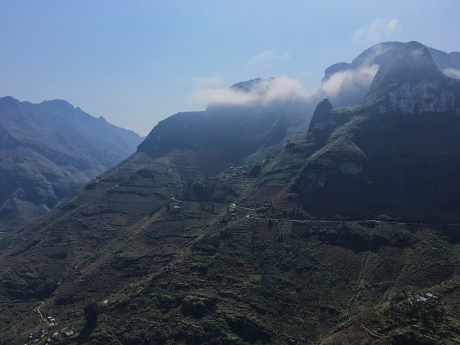
Another brutal day on the road.  I finally got that rain that was promised, and it was so much colder than I expected.

File_001 (8).jpeg
My gear stayed dry! But I did not.

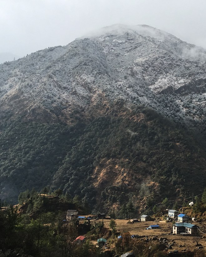
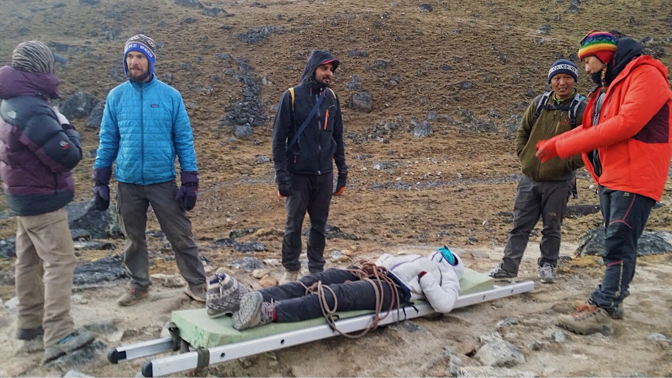
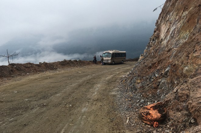
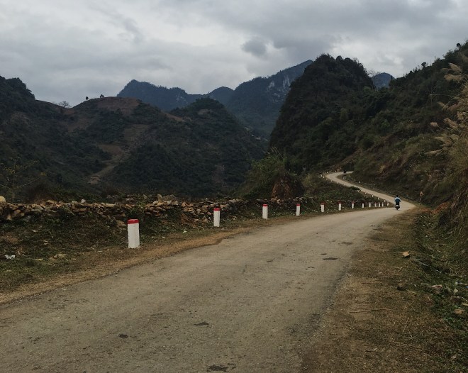
I was just hiking in Nepal in December, and I thought I could deal with the cold.  But this was brutal.  I got soaked within my first couple hours of riding, and it just wrecked me the rest of the trip.  At least when you are hiking, you are moving.  I was able to stay warm even up at 18,000 feet! A few minutes on a bike, soaking wet, with the wind, and lack of movement, and I was miserable.  Coming into Meo Vac, I was in an actual cloud, and couldn’t see 5 feet in front of me.  The road conditions were almost as bad as the previous day.  Combined with the weather, I decided to throw in the towel at Meo Vac, half way to my intended destination (again).   I did have supposedly the nicest day of riding in front of me anyway, and I didn’t want to do it in the rain and clouds.

File_005 (4).jpeg
As I am riding 2nd gear downhill, the road ends and turns into mud, on top of a cliff.  Dope.
File_006 (3).jpeg
Fantastic visibility.
File_000 (8).jpeg
At least they are working on them!

As I rode into Meo Vac, I did get some great views.  And then, a drunk sleeping in the road, this time in the middle of the highway.  What the fuck is going on up here? People were just swerving around him, and pretty much ignoring him.  With the visibility being what it was (and how popular drinking is), I was worried someone was going to run him over.  I was able to convince an army officer to help me carry him to the sidewalk, although he was less than enthusiastic about it.  Maybe I am too soft for this country.

File_001 (7).jpeg
Some Hmong women on the highway, clearly stronger than I am.
File_002 (6).jpeg
These kids all ran up and gave me a high five as I drove by.  I guess they heard white people like high fives (we do).
File_004 (4).jpeg
This was my favorite view of the day.  I was also stoked to not be inside that cloud anymore.
File_000 (9).jpeg
This really cool dam I drove past, just outside of Bao Lac.

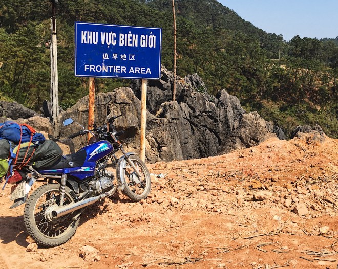
After some searching, I found a guesthouse, and it was fine.  Until the owners banged on my door at 10:30 PM, demanding 210,000 dong (about $21), for some permit for being in a border area.  Now, it turns out the permit is legit.  But was this the best time to ask? I checked in 5 hours ago.  I was checking out and paying tomorrow.  Why are you yelling at me in a language I don’t understand at 10:30 at night? There was one other person staying at this guesthouse, and they pulled me over to his room to explain the situation.  He very politely told them to fuck off through google translate, and that he was trying to sleep.  I was actually pretty impressed with this, as I just yelled at them (in English).
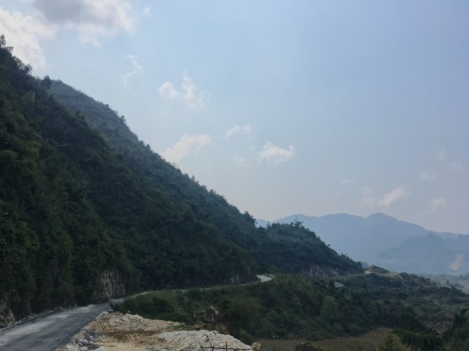
Bao Lac


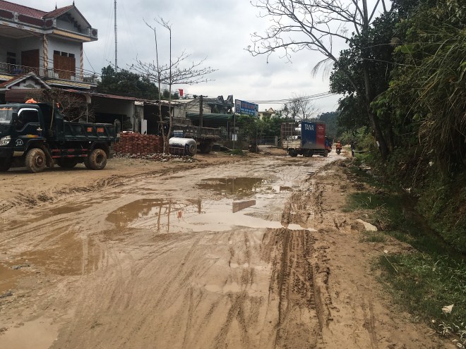
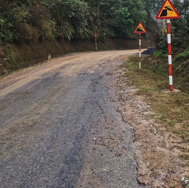
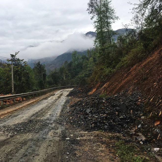
This was my most challenging day in Vietnam so far.  I had bad vibes leaving Cao Bang.  The weather was shit, I was in a weird, existential crisis type of mood (it happens traveling solo sometimes), I left later than I planned, and had a huge day planned that I was worried about making.  On top of all of this, the “roads” totally disappeared, my bike went down and I got into an accident.

File_009
A strange bike to be owned by a local, but cool as fuck nonetheless.

I started driving through these bizarre, border frontier villages, that straddle the border of China.  It felt like driving through the USSR, if the cold war happened and the US won.  The people, for the most part, were friendly.  The towns just had this empty, cold feeling.

File_002 (3)

File_007 (2)File_005 (3)

I bought smokes in this village, and after wandering around a bit, chatting to the locals (exchanging smiles and waves), I left. About 5 minutes after leaving the village, I saw a dude laying face down in front of his bike.  This is a complicated issue.  This isn’t my home, and that was none of my business.  Maybe I should have kept driving.  I don’t understand this country, and especially don’t understand these Wild West type of villages that I have found myself in.  But I saw a lot of dark stuff in Myanmar, and I couldn’t help or do anything.  I know bad stuff happens.  What bothered me was the apathy.  In everything we saw in Myanmar (death, injuries, drug overdoses), we were chased away by locals who treated it as a common occurrence, and nothing to be worried about.  It probably is, and I am probably a privileged American for treating it any differently.  Life is hard for most of the world, and I am lucky.  But it still shakes me to see life and suffering treated with such indifference.

File_006 (2)

With all of that on my mind, I hit my brakes and started pulling over.  I honestly thought this dude was dead.  As I am pulling over, I got hit from behind.  These guys must have been a foot behind me, which I guess isn’t surprising, experiencing the driving out here.  They both flew off of their bike, but I was able to stay upright and get my kickstand down.  I rushed over and helped them up, and they were fine, but had no interest in helping the possibly dead dude lying 20 feet away from them.  I got over to him and saw vomit everywhere.  I couldn’t tell if he was even alive, until he started puking again.  I could smell the rice wine from a few feet away.  I guess he was just super drunk (at noon?) and pulled over to have a nap on the shoulder of the highway? But isn’t this how Jimi died? Choking on his own vomit? He wasn’t responsive at all.  I didn’t want to leave him there.  I grabbed my water and left it in front of him, and start trying to wave people down, because I don’t speak Vietnamese and really don’t understand where I am anymore.  About a dozen people pass, and 3 stopped and laughed, before someone finally comes to help.  We got him upright and talking, and drinking water.  The good samaritan thanked me and basically told me to leave, so I did.  At least I left knowing he wasn’t dead.

File_002 (5)
It only got worse from here.

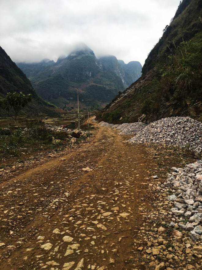
After that, it was just a grind, and some of the most challenging riding I have ever done.  The roads would disappear, and turn into construction zones.  At first it was just dirt, but coming down a really steep pass, it was an actual boulder field.  I am ok on a bike, but I have no idea how to drive through this shit, especially downhill.  I put my bike down once (too much front brake), and decided to start walking it through these areas.  I literally got a room at the first hotel I found, about halfway to where I decided to go that day.  I was done.  I really hope tomorrow is better.

File_000 (6)
Bleak skies but nice views.
File_001 (5)
Some rare paved road!

File_003 (3)

File_004 (3)
I never get tired of seeing all of this green.  It was a nice cap to the day.

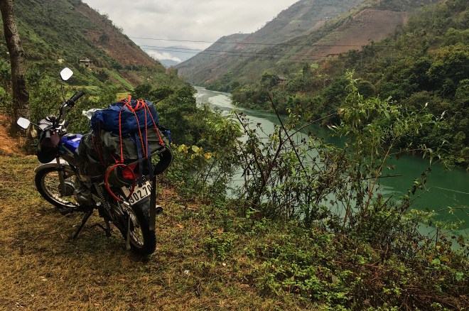
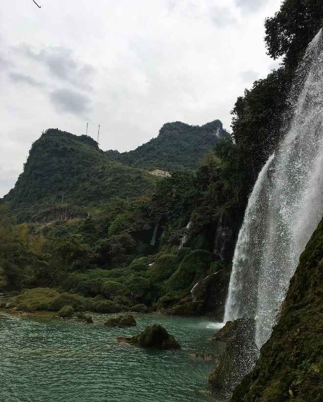
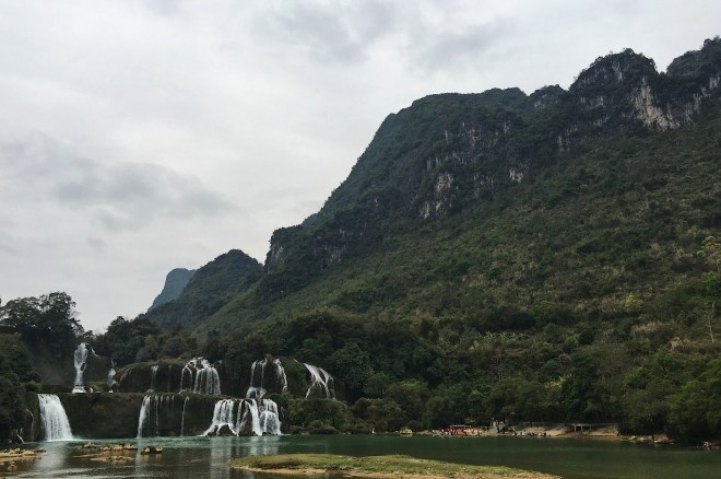
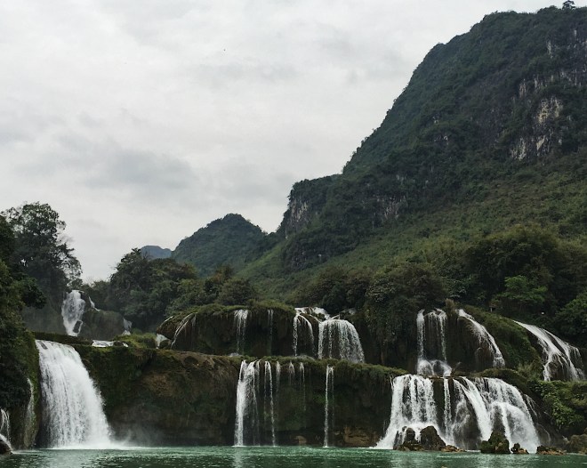
Ba Be Lake – Cao Bang -Ban Gioc Waterfalls:

I actually found a really nice hotel here, so I decided to hole up for a few days to finish my blog, get some scheduled work done on my bike, and go see the waterfalls.  I went into 4 different hotels before finding this place, as this close to the Chinese border, they tend to overcharge due to tourism from China.  Every hotel was trying to charge about 4 times what I ended up paying.  One of the kids was nice enough to point me down the street, where the locals stay.  No one at the hotel seems to speak any English, or give a shit that I am here, but they let me keep some beers in their fridge downstairs, there’s a great ban mi spot right around the corner, and the internet works most of the time, so I like it.

File_005.jpeg
They really love Ho Chi Minh up here.

I was warned about a strong anti-American sentiment up here, especially the farther North you go.  I am also in a place not well traveled by Western tourists, and am very obviously American.  I am literally as far North as you can go, and people have been great.

File_002.jpeg
Getting some work done on my baby.  This dude spoke 0 English, but did all the scheduled maintenance, charged exactly what it should have cost, and was pretty chill.  Thanks dude.

No one speaks any English, so all the communicating is through sign language or Google translate.  It usually leads to some pretty funny interactions.
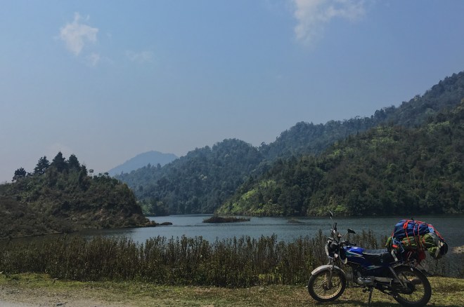
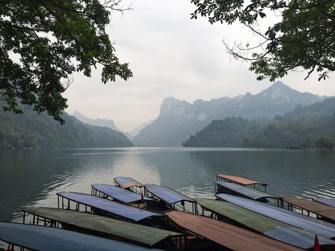
File_003 (2)
The drive really started to get nice in this area.  The roads are surprisingly well built and sealed, and wide enough that I don’t have to drive on the shoulder to avoid dying every time a truck drives by (like in Myanmar).
File_008
I think it took me about twice as long to get to the falls, because I kept stopping to take pictures.
File_004 (2)
These limestone cliffs are so dramatic.
File_005 (2)
I accidentally drove into China, which was really easy considering how they feel about the Chinese up here.
File_002 (2)
Just more amazing limestone mountains, no big deal.
File_007
I hiked up to one of the side waterfalls and got a pretty cool view.
File_006
The river straddles the border of China and Vietnam.  Each country has their own set of tour boats that take you under the falls. This is the Chinese side.
File_000 (5)
For how nice these falls were, I didn’t see a ton of people up here at all.  I am not a huge waterfall guy, but these were really cool, and the drive up was awesome.

Ba Be Lake:

File_002 (1).jpeg
Dinner time!
File_007 (1).jpeg
This adorable kid and grandmother that lived at the place I was staying.

Ba Be lake is a national park in Vietnam that seems pretty popular with the locals, although I didn’t see many foreign tourists.  The lake is the largest in Vietnam, but kind of underwhelming compared to the scenery around it.

File_003 (1).jpeg
I didn’t take any of the boat trips, the views are good enough from here!
File_008 (1).jpeg
Kind of scary crossing this bridge, as it’s not wide enough for a car and another vehicle, and drivers here do exactly what they want when they want.
File_005 (1).jpeg
I really loved just driving around the countryside and fields here.

Bac Kan:

File_001.jpeg
The drive is getting better!

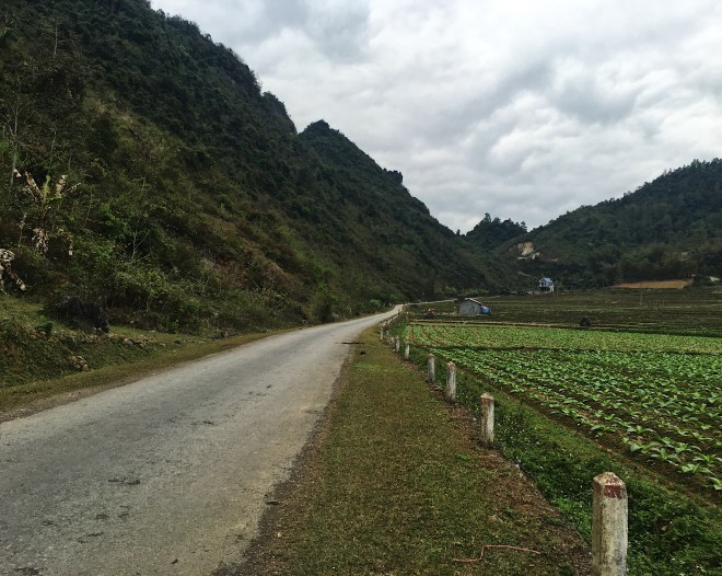
This was a little less terrifying of a day, and the views are getting a bit better. I drove onto a freeway that had a sign that I think said no motorcycles.  Traffic rules are a complete formality here, so whatever.

File_000.jpeg
It will never not be weird seeing the pick and sickle everywhere.  I love these entrance gates though.  Every town seems to have one.
File_006 (1).jpeg
Rain in the forecast! Hiking on the West Coast has taught me how to deal with bad weather well.  Everything goes in a dry bag, then covered in another one.

 Hanoi – Thai Nguyen:

a3d32028-7eb7-4d8d-91eb-bf41bb2c2d5e
I’m off!

65 km

2.5 hours road time

It was a pretty awful drive out of Hanoi with a really late start.  I am not sure I have done anything less safe than driving through Hanoi on a motorcycle.  I was planning to go to Bac Kan, or even Ba Be Lake, but after battling the buses and trucks coming out of Hamoi, combined with my late start, I threw in the towel once I found a $5 home stay in Thai Nguyen on Agoda.

wwfe0061
Selfie during dinner!
mzmy5133
He’s got a good taste in sports teams!
ngdw0151
One of the many wine toasts during dinner.

Winter Trekking in the Khumbu Region: From Jiri to Everest Basecamp and Beyond

Following in the footsteps of Tenzing Norgay Sherpa and Sir Edmund Hillary.

This trek I did in the Khumbu region is hands down the most amazing hiking experience of my life, and I could not recommend it enough.  I am a habitual ranker. I rank everything. My favorite food, favorite countries, favorite rappers (Black Thought from the Roots, this isn’t even an opinion, he is the actual best, see examples: 1234, 5), and of course my favorite hikes, and this is it.

273cc7db-5677-4fca-ab0d-f09af8f628d3
This is actually from the Langtang trek, but the sentiment is relevant.  I love Nepal.  I also love the Huskies and Mariners.

After trekking in Langtang and the Annapurna region (also in Nepal, and amazing), I still held the John Muir Trail in California as my favorite hike of all time. That is until I trekked in the Khumbu region. The views are stunning and better than anywhere I saw in Nepal. The Buddhism is fascinating and inspiring (it is actually illegal to kill animals in the Khumbu region, past Lukla). The stupas (a statue containing religious relics, used as a place of meditation), monasteries, and prayer walls were inspiring. The people were incredible. I also loved the time of year I chose to do this hike.  I had clear skies and sun for the vast majority of the hike, and relatively empty trails.  What more could you want?

197
Nothing but sunshine (mostly).

The side trips are almost endless. The variance in scenery is unparalleled. Everything from lush cloud forest, moon like landscapes, and towering mountain vistas are all available on this trek. Solitude can be had at will. I spent the vast majority of my time on this trek hiking alone or with friends of my choosing. I cannot wait to come back and hike in this region again, it is truly a special place.

754a5779-2485-4265-acb5-da1148910abd
The gorgeous village of Nunthala, as seen descending Taksindu La.

General Route & Timing Info:

My trek was a bit of a Frankenstein, combining the Tenzing-Hillary Trek with the 3 Passes Trek.

The Tenzing-Hillary Trek begins in Jiri and ends at Everest Basecamp (as opposed to flying in to Lukla and hiking to Everest Base Camp, the more popular and shorter Everest Basecamp Trek).  Beginning in Jiri adds anywhere from 5-8 days to the trek, but Sir Edmund Hillary and Tenzing Norgay Sherpa had to begin here, as there was no airport in Lukla when they made their historic summit.  Today it is still worth it to begin here, as the scenery and culture are incredible, and solitude much easier to find than higher up.

The 3 Passes Trek starts the same as the Lukla – Everest Base Camp Trek mentioned above, but adds 3 high passes to cross on the way, and makes the trek more of a circuit, as opposed to an out and back.  The trail breaks east before Everest Base Camp, crosses Kongma La Pass, hits Base Camp, then continues over Cho La Pass, Gokyo Lakes, and finally Renjo La Pass, before rejoining the original Base Camp Trail in Namche Bazar.

My route can be seen below.  I started in Jiri, hiked straight up to Everest Base Camp (skipping Kongma La Pass due to timing and weather concerns), then continued on the 3 Passes Trek over Cho La Pass, Gokyo Lakes, Renjo La Pass, then back into Namche Bazar, where I backtracked almost all the way back to Jiri.

trek-overview
A general overview of the trek. The link below is a more detailed and interactive map.

Interactive map

My Nonexistent Plan

I had an ambiguous and loose schedule by design.  I was given extensive information and inspiration by Seth Wolpin, who is also hosting this write-up at Himalayan Adventure Labs.  Without Seth’s guidance, this hike, or write-up would not have happened.  Thank you Seth!  I set off with a few hundred dollars in rupees, my gear, and a very general idea of timing.  If this works for you, I highly recommend it for a few reasons:

  • Elevation gain and distance are different in the Himalaya.  I am a monster in the Sierra Nevada or Cascade Mountains in the USA.  I’ve had single days with 30 miles or over a mile of elevation gain on some of my previous hikes in California with relative ease.  None of this translates in Nepal (for me at least).  The trail conditions are rough and elevation can have unpredictable effects, even on the same person, after extended periods of time at high altitude.
c099b229-a544-45ea-95d9-f60c5d02f66b
Even after climbing Thorong La Pass (17,769 ft) a month earlier, and staying pretty high up my entire 3 months in Nepal, I had some rough days on the Everest Trek and needed to chill. It is always best to listen to your body.
  • Sometimes you meet people you want to hike with, which will always change plans.
9d7a61bb-bab9-4e0b-be87-8d48945453a3
A crew of locals I met on the bus to the Langtang trek. I changed my whole plan to hike with these kids, and I am so happy I did. This was my first week in Nepal, and this was a perfect intro to the culture and people. They were amazing ambassadors for their country, great friends, and I still talk to a few of them. Thanks dudes!
  • There were days where I got somewhere so dope, I had to stop for the day, even if it was noon.  I never would have known where these places were until I saw them myself.
47ef6fb4-a099-4917-90ec-efbd4aa34fbf
Yup, this will do for the night!

For these reasons, I really suggest a loose plan, and to just follow your heart.  Nepal works best that way.

Total Days on Trail: 26

Rest (Zero) Days: 5
Total Actual Trekking Days: 21

Weather

Hiking in the Himalaya during the middle of winter can be scary!  This isn’t a very popular trek to do in late December, so finding a lot of first hand information was tough.  A mutual friend had done it the previous year, and gave me a ton of great information, and reassured me it was possible (thanks Emma!).  With the weather stats I got from Everest Weather (full disclosure, this is my dad, but he’s amazing at what he does, and has never failed me on any of the skiing or hiking forecasts he’s given me over the years), and the below gear, I was mostly very comfortable.

I had pretty much perfect weather the whole trip.  The days were almost exclusively sunny, clear, and warm enough to hike in single layers (it does get colder and windier on the really high passes, but still totally manageable).  The nights were very cold though.  Within minutes of the sun setting, the temperature drops dramatically.  I was doing laundry and taking a bucket shower in Dzonglha (15,846 ft), on a reasonably warm and sunny day (warm enough to take a bucket shower outside) and had hung my clothes up to dry in the sun.  Minutes after the sun had dropped below the mountain, my clothes were frozen solid.

I did get a little snow right around Christmas (even this atheist Jew can appreciate a white Christmas!), then a lot more once I got past Lukla and got into Phaplu in January.  Aside from that, it was clear and gorgeous every single day, and freezing at night (but clear with amazing stars and lit up mountains).  I would (I actually will) come back this same time of year to hike again.  It was pretty much perfect.

15bb7630-06f6-4b14-9578-c9d861bfe71a
Winter is coming.

Gear

*Purchased in Kathmandu.

It won’t be high quality or even real, but it’s cheap, and if you’re traveling, a nice option so you don’t have to lug around a ton of cold weather gear.  You can find anything you will need for trekking or climbing here, I just wouldn’t plan on using it again, because it is all mostly shit.  Also a great option if you are a moron and leave your trekking poles in a jeep, as you can buy new ones for like $3.

  • Short sleeve synthetic shirt
  • Long sleeve UW Under Armour synthetic shirt (GO DAWGS)
  • Patagonia trekking shorts
  • Jack Wolfskin trekking pants
  • Patagonia Nano Puff jacket
    • I love these jackets, and they are mostly great, but this was inadequate for this hike for this time of year.  I was fine during the day, but spending time outside after sunset was a bit uncomfortable.  I should have purchased a real down jacket in Kathmandu.
    • This jacket has since been destroyed in a motorcycle accident.  RIP baby blue Nano Puff.
  • Marmot PreCip lightweight rain jacket
  • Heavy weight fleece*
  • Heavy weight merino wool tops and bottoms
  • Mid and heavy weight wool socks
  • Synthetic trail running socks
  • Wool cap
  • 2 pairs Exofficio travel boxer briefs
  • Glove liners
  • Heavy weight down over-mits*
  • Crampons*
    • I bought mine in Namche Bazar to avoid carrying the extra weight until I needed them
    • More like Yak Traks, very necessary for Cho La Pass; I sprung for the nice pair, maybe $20
  • Marmot Helium 15 Degree bag (I did not bring it on the Annapurna Circuit and had enough blankets every night. This was in November and much lower.  I was very happy to have it on this hike.)
  • Trekking poles*
  • 2 Maps*
    • 2 maps must be purchased for this trek, as it is not a traditional trek. I used one map for the Jiri to Everest Base Camp section, and purchased a separate 3 Passes map.
  • Brooks Cascadia trail runners
998
I did about 2 solid month of trekking in these, and loved every minute of wearing them. They do not still look like this though.
  • Mariners baseball hat (Very important. GO MARINERS!!)
  • iPhone
    • Kept in airplane mode, using only maps.me (previously downloaded Nepal maps) as a reference
    • Anker 20,000 power bank (charging costs money, so I was very frugal with my phone usage)
    • Music
a035bed3-10ae-44b9-9627-6c7bdc978a5f
Go Dawgs forever.

Music

File_000 (1)
BAD AND BUDDHA I spent much of my time in Nepal listening to Atlanta hip hop and spinning prayer wheels, so this is insanely relevant, and one of my favorite things ever. Dabbing Buddha was created by my talented friend Ayush Banjade.

I really like music when I hike.  Wifi costs money on this trek, so I downloaded everything I wanted to listen to before getting to Nepal (even in Kathmandu the wifi isn’t great).  I use Apple Music (for those Drake and Future exclusive releases!).  If you care about my (mostly terrible) taste in music, see What I’m Listening To (a work in progress, and will be updated when I feel like it).

Reading

I read a ton on this trek, as the sun set early and the nights are cold.  I prefer hard copy books, since wifi and power are in short supply, and there are plenty of book stores that will sell and sometimes buy/trade in Kathmandu and Namche Bazar.  Other trekkers are also happy to trade or give away books to shed weight, and some guesthouses even have book exchanges.  I typically like to read books that are relevant to what I am doing or where I am traveling, as it adds to my experience.  There is no shortage of amazing books about Nepal, climbing in the Himalaya, or just hiking in general.  These were my favorites, and can be found in any bookstore in Kathmandu or Namche Bazar:

Snow Leopard

91gsahsjwsl

Peter Matthiessen is a travel author and zen Buddhist, who treks with his friend, a biologist, in search of Blue Sheep, Snow Leopards, and Yeti* in the Himalaya.  He writes about trekking, but also about Buddhism, local culture (Sherpa, Tibetan, Nepalese), grieving, biology, and Yeti! This was kind of a challenging read, it took me 100 pages to really get into it. But I loved it.  It taught me a ton about the region, biology, and culture I was immersed in.  It was also beautifully written and informative, and is also just a cool story about an amazing trek that lasted months, and is way tougher than anything I will ever do.  This is a must read if you’re trekking in Nepal.

yeti

*The Yeti, a giant pre-human primate (think Bigfoot, but in the Himalaya), is a huge part of Nepali folklore, and still a big part of the culture today.  Scientists generally agree that the Yeti doesn’t exist, but there is a Yeti scalp on display in a monastery in Kumjung, and there have been sightings by many reputable mountaineers, like Reinhold Messner, and even Sir Edmund Hillary himself!! Matthiessen also provides some interesting opinions on the issue in his book.  I am not saying they definitely exist, but they probably do.

Touching My Father’s Soul: A Sherpa’s Journey to the Top of Everest

51kchpkrbol-_sy344_bo1204203200_

This is a great book written by the son of the first person to summit Everest with Sir Edmund Hillary. This was so cool to read, as I was literally walking in Tenzing and Hillary’s footsteps to reach Everest.  It has more great insight into Buddhism and Sherpa culture, as well as a first hand account of the 1996 disaster on Everest. Jon Krakauer basically said it was better than his own book on the same disaster (see below, also a great book). It’s absorbing, hilarious, endearing, and a really easy read.  I think I crushed this book in like 3 days.

Into Thin Air: A Personal Account of the Mt. Everest Disaster

511pyvwg3yl-_sy344_bo1204203200_

Required reading for Nepal, by one of my favorite authors.  I read this book when it first came out, and is one of the reasons I ended up in Nepal.  I love Krakauer’s writing style.  It is so engaging and down to earth, yet he is so knowledgeable.  In my opinion, he is the gold standard of adventure/climbing/hiking journalism.  The story itself is tragic, but a great learning experience for anyone looking to venture into the mountains.

Into the Wild

into-the-wild

Another classic by Krakauer.  Krakauer is sympathetic to McCandless’s tragic (yet kind of inspiring) story, and this definitely shows in the book. Where the movies paints McCandless as some young, spoiled idiot (by leaving out key facts that Krakauer reveals in his book), Krakauer shows us that McCandless was simply a lost, sensitive, and while arrogant, honest person escaping a world he didn’t understand, in search of something real.  This book taught me more about myself than anything I’ve ever read, and might be one of my favorite books of all time.  It’s also like a 100 pages.  Read it.

Transport

482
The buses always say “WIFI”, “Speed Control”, and “Suspension” on them. None of the buses I rode in Nepal had any of these features. Photo by Andrew.

Kathmandu -> Jiri
• Local bus from the Old Bus Park, close to Thamel, direct to Jiri

Phaplu -> Kathmandu
• Local bus, organized through my guesthouse in Pahplu

I do not remember the cost of the bus, but it was an insignificant amount of money, and I am sure changes frequently.  If you buy your ticket directly from the bus park in Kathmandu, or from a trusted guesthouse owner (pretty much anyone, especially once you leave Kathmandu), you will get a fair price.  This is the cheapest form of travel in Nepal (for good reason).

Fees/Costs

TIMS Card: $20
Gaurishankar Conservation Area $20
Sagamartha National Park: $33.90

In true Nepali “figure it out as you go” fashion, I purchased all of these on the trail, very easily, at no additional cost. I think this is the better option than navigating the tour and sales offices of Kathmandu. I didn’t even need to know where these offices were located, as the National Park and TIMS officials waived me in off the trail, to either check my permit, or sell me the required one. I was never over charged, and always offered friendly conversation and advice.

Daily Budget: $30/day

• This budget allows for 3 meals a day and lodging, but does not include the above permits

• This could be done for less with some creativity and frugality, or more if you like to indulge in candy, beer, or western food

nepal-chitwan-kathmandu-bungy-364
Looks pretty tempting after a long day of hiking, right? These go for as high as $10 once you get past Lukla. Plus, alcohol isn’t great for acclimatization. Best to save the beer for Kathmandu, and stick to water.

A note about ATMs:

• The only ATM on this trail is in Namche Bazar. There could be ATMs in either Jiri or Phaplu, but neither are much help as they are at the very beginning or end of the trail

• The power and internet were out in Namche Bazar for almost a week, stranding me there as I had run out of cash. In Nepal, you can always figure things out (my hotel let me run up a tab until the power came back on).  It would be best not to rely on this ATM, and just bring 25%-50% more cash than you think you’ll need

Food

nepali-dal-bhat
Dal Bhat Power 24 Hour.

I have been traveling for months now, from South America to all over Asia.  Nepali food is hands down my favorite of all the countries I have been to.  It is simple, healthy, very veg friendly (you typically have to try to have meat, most of the food is vegetarian or even vegan by default), tastes amazing, and somehow doesn’t ever get old.  It is the perfect food for trekking.

Dal bhat is pretty much the national food of Nepal, and is commonly eaten for lunch and dinner.  It consists of rice, lentil soup, curried vegetables and potatoes, some greens, and some pickled/spicy vegetables.  I ate this every single night of trekking (around 2 months), plus half of my non-trekking time in Nepal.  It never got old!  It was a little different everywhere I had it.  The only thing consistent, and my favorite part about it, is you always get more! Sometimes it’s just seconds, but typically they will offer you more until you beg for mercy.  I have put down 4 servings of this stuff in one sitting.  The highlight of every night of trekking was inhaling as much of this stuff as I could before they came around offering seconds.  I am not a disgusting glutton, I promise.  When you hike all day, you burn a ton of calories.  Hiking at high altitude requires even more energy, as does staying warm during the cold nights.  That is why dal bhat is perfect for trekking.  It has carbs, protein, greens, and it’s bottomless!!

There are various forms of Western/Chinese food available in all the tea house I stayed at.  But none of these were bottomless (this isn’t Golden Corral), so in the end more expensive.  I also didn’t come all the way to Nepal to eat shitty pizza for dinner.

Guide

I am a big fan of trekking independently. I love the freedom it offers, and as a budget traveller on a very long trip, this was my method of travel for all of my treks in Nepal.

That being said, when I go back, I will absolutely be hiring a guide. On all 3 of my treks, I witnessed first-hand the guide community in Nepal, and it is fantastic. They are well trained, knowledgeable, and just fun to hang out with. They are well worth the relatively low cost they charge for their services.

I hiked extensively with one guide and his clients in particular (I didn’t hire him, they just invited me along), and would definitely recommend him.  His clients raved about him, and I had a blast hiking with them. He was very knowledgeable about local tradition and culture, hiking and the mountains, and flat out one of the friendliest and most genuine people I met in Nepal.

bishnu-co
Jonathan, Bishnu, and Nick. Always the funnest dudes in the guesthouse.

Bishnu Lamichhane

Funny Nepal Treks and Expedition

Guidebishnu1992@gmail.com

Getting to Jiri

ktm-jiri-1
The route looks right, but never trust the time estimates in Nepal.  They don’t account for the bathroom stops (that aren’t at actual bathrooms), the numerous lunch and snack stops (that do have bathrooms?), the always terrible road conditions, and the very possible mechanical issues.  Will it be 6 hours? Will it be 12? Will your driver pull over and take a 4 hour nap? It’s all part of the adventure! Bring some music (you’re not reading on any of these buses I promise), or better yet make some new friends.

I took a public bus to Jiri. This bus leaves from the Old Bus Park in Kathmandu. I went to the Old Bus park the day before to purchase my ticket and get confirmation on the timing. They leave very early in the morning, and although I was told they run until 8 am, I opted for the 5 am bus just to be safe. We were also budgeting a 10 hour ride, so we wanted to get an early start. Any hotel or taxi will know where the Old Bus Park is, just make sure to clarify you are going to Jiri to leave no room for confusion.

Even on my most horrific bus rides in Nepal (I’ve had some truly terrible experiences), the locals and bus drivers have always been amazing and helpful, and I have always arrived where I needed to (give or take a few hours). No exception on this route! Fun locals, great lunch stops, gorgeous views, and a relatively smooth ride! This was my easiest and most pleasant bus ride I took in Nepal. Anyone on a budget, or just valuing an interesting and authentic way to travel should have no issue on this route.

489
Andrew, Alex, and Peter making the most out of a broken axle.  Photo provided by Andrew.

Jiri – Shivalaya (1 Day)

shivalaya-route

The bus took about 10 hours. We arrived in Jiri at about 3. We should have stayed there for the night, but we decided to push on to Shivalaya. I do not recommend this, as there are no guesthouses until Shivalaya, and we ended up hiking well into the night.

Shivalaya – Namche Bazar (8 Days)

shivalaya-to-namche-route

This section is not easy. The total elevation is not as high as achieved higher up on the trek, but the gain/loss is brutal, sections of the trail are pretty rough, there are donkey trains, and because of the lack of other trekkers, a map is necessary. That being said, for the reasons listed below, in addition to the training and acclimatization achieved, I would not miss this section for the world.

fca0ae27-7dab-4774-93dc-937c40202ac3
These villages feel like stepping in to time machine. This is Ringmu, completely surrounded by Himalayan forest, mountains. And probably Yeti.

The section of the trail has some of the most authentic and least spoiled Nepalese culture I witnessed in all of my trekking in Nepal. It is not well traveled by tourists, as most opt to fly into Lukla. We had the trail to ourselves (aside from school children, guides hiking up to Lukla to meet clients, and the locals hiking in between villages).

image-31
Village life in Nunthala.

As a result of the lack of tourists, we were much more of a spectacle to the locals than I found on more popular routes. This is fun! People love to chat, ask where you are from, give you great info on your hike, or maybe just practice English! The kids were hilarious. Some of them begged around the smaller villages, and I wish I had brought some paper/pencils to give them, as it is not advised to give money or candy. But most wanted to practice English, hike with me, try on my sunglasses, and have me take pictures of them with my camera so they could see themselves (then exclaim “how handsome!”).

ef270ad2-a75a-4cfb-9ef4-307973d175e2
Stuntin is a habit.

The scenery on this section is gorgeous. We hiked through lush forests, rice terraces, farm land, and up and over some passes with gorgeous views of the Himalaya. The mountain views were surprisingly great very early on. As opposed to the Annapurna circuit, where you have to hike for a few days to get the good views, Numbur makes an appearance as early as the second day.

8726a0a2-bc35-4f0e-9e59-ee17b2922aac
Numbur making an early appearance.

We had an amazing panorama in Phurthang, at a guesthouse that seemed to be either attached to, or the same as a cheese factory. The owners were lovely, they made incredible dal bhat, and the sunset was one of the best we got on the entire trek.

d3c6eef1-3b99-43b2-8867-e8bd2464a3fe
Full moon, alpenglow on the Himalaya, and a Pagoda to add some scale. What else could you possibly want?

Speaking of guesthouses, my favorite one was the Khumbu View Lodge, in between Puiya and Surke. The lodge is owned and operated by Pemba Galjen Sherpa. The food and lodging were awesome, and Pemba and his family were very accommodating. They offered me the most authentic view into Sherpa culture that I had in Nepal.  This included eating traditional food with their family, drinking tongba (hot wine made from millet), and hearing stories of Everest summits around a fire. The view isn’t bad either.

image-9
Not a bad place for morning tea! Photo by Pemba Galjen Sherpa

It is not necessary to hike into Lukla, as it is somewhat off the trail. I was able to hike from Puiya all the way to Namche Bazar. It is not easy, but I had already been trekking for over a month in Nepal, so I felt strong. This could easily be broken into two days.

d4f6cc70-b37a-4a3c-be0a-0c989a54a949
For no reason at all, here are some cute ass goats.

Once I got past Lukla, the trail got much more crowded, and this didn’t let up until I left Everest Base Camp for Cho La Pass. My Norwegian friend that I met on this section of the trail liked to start late and hike until sundown, as the twilight hours offered more solitude and gorgeous lighting for pictures. I found this to be a great strategy for avoiding the crowds and donkey trains.

6bc39ba3-c39a-4620-b9be-33abc03380df
The dreaded donkey train. I know they are necessary for supplies to be brought up (for us and more importantly, the locals), but they are not fun to hike behind. They can go on for miles, they are pissing and shitting machines, and have 0 spacial awareness.  I have been nearly knocked off of a cliff by a donkey more times than I’d like.

Namche Bazar was a great place to recharge, eat, drink, buy more supplies, and rest. I bought warmer clothes and crampons here (for Cho La Pass). It can be a bit of a money pit, and I enjoyed it much more on my way down (it felt more earned). I spent two days here before setting off for Everest. I loved the Khumbu Lodge. The owner was hilarious and kind, the food was great, and they had rooms for budget backpackers like me, as well as actual hotel rooms for more short-term travelers with a bigger budget. It is also where Jimmy Carter stayed. If it’s good enough for him, it’s good enough for me!

162f3abd-f18b-4b62-8b4f-fa04672b2d09
A nice side trip out of Namche Bazar is to hike to the Everest View Hotel for lunch. I found the hotel to be over priced, so I kept hiking and found this incredible stupa dedicated to Sir Edmund Hillary. The view of Everest came with it for free!

Namche Bazar- Everest Base Camp/Kala Patthar (3 Days)

ebc-route

I had a really late start leaving Namche Bazar, so I only made it to Tengboche that day. There are only a few guesthouses here, all with similar accommodation. The monastery is gorgeous and the view was great.

d8f8ec37-0003-4e43-8e93-a99a9f822d76
Ama Dablam (far right) might be the most threatening looking mountain in the Himalaya.

From Tengboche I hiked all the way to Lobuche, taking the high route above the canyon, and skipping Dingboche. The views on this trail were stunning, and felt like a truly alien world.

4a163656-0b42-4195-9d1c-5b0228a935fe
Hiking in an alien landscape.

There is a memorial for fallen climbers right before Lobuche.  It was a very powerful experience, and should not be missed.

ea1bc092-c286-4baf-94de-248696722521
“Go to sleep forever in the Everest”

From Lombuche to Everest Base Camp can easily be a full day, but I opted for tackling Kala Patthar as well. This was a tough day, but worked out perfectly. I left most of my gear at the guesthouse in Lobuche (TO EBC Guesthouse, very nice kids, one of which actually hiked with us to basecamp just for fun!), hiked to Everest Base Camp, came back to Gorak Shep to get a room and lunch, then hiked up to Kala Patthar for sunset, leaving around 2 pm from Gorak Shep.

0dd1e538-74d3-479a-aa4c-54ded169b1aa
The trail up to Lobuche.

We stayed on top well into sundown, and had to hike down in the total dark, but it was absolutely worth it. Bringing a thermos of hot tea helped (thanks Paul!).

58214f2f-58d5-4d5a-b431-94f20237ecc7
Everest looking pretty in pink.

I met many people who skipped Everest Base Camp. I have to admit, compared to the other views, it wasn’t the best. If timing is tight, it could be skipped in lieu of Kala Patthar. However, if possible, I would definitely recommend both. While the views from Everest Base Camp aren’t stunning, you are standing in the middle of the Khumbu Ice Fall.  It is majestic and the power is tangible. I loved it, and I am really glad I made the trip.

47a1809c-dbe3-46fe-aebf-89dfd159b3a6
The giant, noisy, dangerous, and powerful Khumbu Ice Fall, in all its glory!

The trail to Basecamp can be a little tricky. It wasn’t well marked, and during the off season, there isn’t a lot going on at Basecamp, so it can be easy to miss.  Luckily I had a guide, who worked for head scratches and coconut biscuits.

988bc21e-3d99-414c-b800-0f82089ec4f9
Hiking with dogs is just about the best thing on earth. This dude hiked with me all the way from Lobuche, and is taking a well deserved nap at Basecamp. He is a very good boy.

Lobuche – Cho La Pass (2 Days)

cho-la-route

ef83b415-1401-47e4-94de-b82af494c5ab
The shear scale of the landscape here is indescribable, and really tough to capture in a picture.  Photo by Paul.

Another late start held us at Lobuche for another day, as we were all tired from the monster day we had before. From Lobuche we hiked on an absolutely surreal trail to Dzonglha, which serves as a basecamp for Cho La Pass. This was a short day, but it worked out well because the views and surroundings are amazing, and we spent a ton of time taking pictures and just being in general awe.

e359b90b-80b2-4b58-ac5a-a3a8fdc75022
Trails like these make me feel like I am flying or walking in the sky (this isn’t just the Nepali hash speaking). I honestly don’t have any adjectives left to describe this.

That night was spent discussing Cho La Pass, which would be attacked the next morning.

41546434-068d-42f5-aa68-874cfd033a06
Cholatse, above the clouds just like Gang Starr.

A word of caution about Cho La Pass. It is recommended to do this pass with a guide, or at the very least with a group. I have done some mountaineering, and was hiking with a couple of dudes I met in Gorak Shep (turned out to be great dudes, and literally saved someone’s life!), so we did not feel the need to hire a guide. At the very least, you absolutely have to have “crampons” (which can be purchased in Namche Bazar), and should not be alone. It will always require glacier travel, and when we crossed, there was no cover snow at all. It was all ice. Case in point:

image-36
As far as glaciers go, Cho La Pass isn’t especially challenging. But it is a glacier, and at the very least, requires “crampons” (spikes that can be purchased in Namche Bazar) and a hiking buddy. A guide is recommended though, as the trail can be hard to find.

A very nice couple we met in Dzonglha had been hiking together, without a guide. They opted to follow the multiple groups of people over Cho La Pass. The group in front had a guide, and the rest of us broke into smaller groups and followed them. The couple, along with my 2 friends from Gorak Shep, were the last over the pass. I saw them cross the glacier, pointed out my path to them, then descended quickly, as I was starting to really feel the elevation and was a bit worried about my health. I got to the first guesthouse I saw and ate lunch. 30 minutes later my friend Paul ran in saying the woman hiking behind them had fallen off the glacier and injured herself. Her and her boyfriend were stuck on the glacier, with our other friend, waiting for some kind of help. The descent off of this pass is sketchy and dangerous with healthy legs, it would be impossible to do if you couldn’t even walk (she couldn’t). We did not know if they had insurance for a heli ride, the sun was starting to set, and we had already had one of the toughest days of hiking on the entire trek.

Freezing our asses off. Photo by Paul.

As luck would have it, I just happened to eat lunch at a guesthouse owned by Pemba Tenzing Sherpa, one of the toughest human beings on this planet. He grabbed a guide who was playing cards with a client, and the 4 of us set out as the sun was setting, up the pass we had just come down. We found our other friend first, as he had left the couple when the sun started going down. At dark, we found the couple, and loaded the woman onto a stretcher that Pemba had made out of a ladder. The 5 of us rotated on the back of the stretcher, while Pemba manned the front himself, stopping only to smoke (Sherpa oxygen!). The woman was in good spirits, but freezing. The temperature drops dramatically at night, and the only reason we weren’t also freezing was because of all of the hiking. Pemba eventually grew impatient with the pace and put the woman in a harness, strapped her to his forehead (porter style), and ran the last mile down the creek bed back to his guesthouse. Everyone got back safely, and the couple was helicoptered out to Lukla the next day. Crossing glaciers is no joke, and mistakes can have huge consequences at 17,000 feet. Luckily Pemba is a real life super hero, so everyone ended up ok.

78861722-a35d-4ff3-aab7-808ae8c681c1
High altitude rescue squad. When Pemba isn’t climbing Everest or saving lives, he’s owning and operating the Tashi Dalek Lodge in Thagnak, raising a beautiful family, and taking pictures with trekkers.

Cho La Pass – Gokyo Lakes – Gyozumpha Tsho (2 Days)

gokyo-route

The hike to Gokyo is tricky, as you have to cross a giant glacier. It is also awesome, because you have to cross a giant glacier!

537d3ac3-d32c-499f-8a4b-a70db076bdf8
Even with the cairns, the trail across the Gokyo Glacier can be tough to find.

This glacier is covered in scree, so no crampons are necessary, but the hiking is slow. Luckily the views are insane, and the glacier makes a very eerie noise as it carves its way through the valley. The approach into Gokyo Village gives you a fairy tale vista, as a collection of guesthouses surround a gorgeous glacial lake. We stayed at the Gokyo Resort for a few days and loved it.

dc766468-cc0d-4ab4-8e84-555d33770423
Gokyo Village, straight out of a damn fairy tale.

The next day we made the hike to the last lake in the series of Gokyo Lakes, called Gyozumpha Tsho. It was an all day hike, but the views were well worth the effort the entire time. The Gokyo glacier looms next to you the entire time. I still think the main lake, by the village, is the prettiest though.

2f8dc698-0341-4e53-8bd6-03207f013dd3
The ominous Gokyo Lake region. The weather sucked on this hike. This was as nice as it got all day, in between wind, rain, snow, and every other form of misery the Himalaya has to offer. Still worth it, and the Gokyo Resort had a roaring fire and hot food waiting for me when I got back.

Gokyo – Renjo La Pass – Lungdhen (1 Day)

renjo-la-route

d9bcea72-bc30-4322-8eae-7658e0a6ad78
“I never show signs of fatigue or turn tired, cause I’m the definition of tragedy turned triumph” – Black Thought, the GOAT, providing much needed inspiration on the last tough part of this hike.

I opted to skip Gokyo Ri, a very popular side trip from Gokyo village. I wanted to start descending as quickly as possible.  The weather had already started to turn, as I had gotten snow on my hike to the lakes the previous day. I was also told that Renjo La Pass offers a very similar view. The hike up was of course brutal.  This trek made me earn every beautiful vista I witnessed. After a gruelling hike up, losing the trail a couple of times (always look for cairns, they are pretty consistent along this part of the trail, I just missed them), I finally got to the top.

74B59144-0608-4208-800B-F6BA6E4EB82A.jpg
It’s just right up there!

I was treated with the most impressive view of Everest I have ever seen. This was also the only view of Everest I saw where Everest appeared taller than the surrounding mountains.

999f22f6-3d7f-41ac-9a01-a8fbcac0a131
Everest in its proper glory, towering over it’s neighbors like it should be.  The best view of the trek.  Photo by Paul.

The views don’t stop on the way down either. All the way to Lungdhen were amazing vistas and surreal landscapes.

image-44
The temperature extremes this high up are actually insane.

Lungdhen -Namche Bazar (1 Day)

namche-2

We decided to push from Lungdhen all the way back to Namche Bazar, skipping the very popular stop Thame. This was a mistake. Thame is gorgeous, has a wonderful monastery, and is the birthplace of Tenzing Norgay Sherpa, the first person (along with Sir Edmund Hillary) to summit Everest. My friends stayed there and raved about it. It was especially dumb to skip, as I ended up stuck in Namche Bazar for almost a week waiting for the power to come back on so I could pull out more cash. They were able to get the ATM working for 15 minutes a day by charging it all day with the solar panels, only to have the internet fail! Namche Bazar isn’t the worst place in the world to be stuck though, and the lovely family at the Khumbu View Lodge let me run up a tab while I ate and drank there. We also had a great NYE party in a dark bar around a fire, complete with live music and raksi (Nepali moonshine). Nepal is one of those special places where even getting stuck somewhere with no power or cash can turn into a wonderful experience.

ef6b5617-b299-49f0-9956-3fa192148935
Not only a gorgeous city, but a paradise for trekkers! Bars, good food, comfortable hotels, and wifi and power (sometimes).

Namche Bazar – Phaplu (3 Days)

The Journey Back

Phaplu route.JPG

The trail back to Phaplu backtracks all the way to Ringmu, where it veers off the original path to head south towards Phaplu. I stayed at my friend Pemba’s guesthouse The Khumbu View Lodge, for one more night with him, his family, and that amazing dal bhat, tongba, and towa (traditional Sherpa food I can best describe as gnocchi, delicious). Pemba was also cooking up some yak steak, from one of his animals which was killed by a tiger (or maybe a Yeti?).  I passed on the yak, but I kind of wish I had tried some. From there I went straight to Phaplu in one day.

71hwxv-apll-_sl1500_
The weather was turning, and backtracking can get a bit monotonous. Tunes helped me a lot. Shout out to Juicy J for keeping it trippy.

After leaving Ringmu, the trail is gorgeous, and the hike into Phaplu is just as amazing as every other inch of this trek. It was surreal seeing the first motor vehicle in almost a month! I stayed at the cheapest guesthouse I found, and had the treat of watching Nepali action movies and REM music videos with a bunch of locals, and eating more great local food.

The bus ride home was not nearly as pleasant as the ride in, and ranks up there with one of my worst (which is saying something, I’ve had some brutal ones). The window next to me was broken and permanently open, so I was freezing the whole time. Then we got stuck in the snow amid an insane traffic pile up of giant trucks, buses, jeeps and mopeds. I was forced to go handle some business in the snow on the side of the highway in front of everyone. I was also somehow colder than I was on the bus ride, which makes no sense at all. But of course, since it’s Nepal, I met some more amazing people, starred in a few selfies, and had some laughs about the whole thing. Eventually we got back to Kathmandu, and I was able to get my old room in Kathmandu, eat 5 veggie burgers, and watch the NWA movie on tv (it was really good btw).

dae9d58d-69c2-4f27-b121-c1cd8822ada7
These roads are a clusterfuck without snow. Single lane highways with everything from scooters to giant buses and trucks fighting for space, riding along terrifying cliffs. Add a couple inches of snow, and it’s a total shit show. We were here for 2-3 hours, watching some of the worst snow driving I have ever seen. Of course it all worked out. I starred in a few selfies, made a few friends, froze my ass off, and eventually made it back to my motel.

Conclusion

8b3cba10-f986-4f89-a89a-919a036065e4

 I love Nepal, love the Khumbu region, and loved everyone I met in this country.  This silly blog does no justice to the magic of this place.  As far as timing goes, I would even recommend going this time of year.  Clear skies and empty trails!  If you like hiking, this needs to be your next trip.